Two exploration campaigns in the Bay of Morbihan and around the « Grande Terre », based on the knowledge acquired during previous programmes, made it possible to choose eight sites representative of the coastal habitats of the Kerguelen archipelago. These sites are progressively being equipped with various measuring devices and are being monitored by photography and video. Other sites may be added to this initial network. The devices are now being tested in Port-aux-Français, near the BIOMARE laboratory.
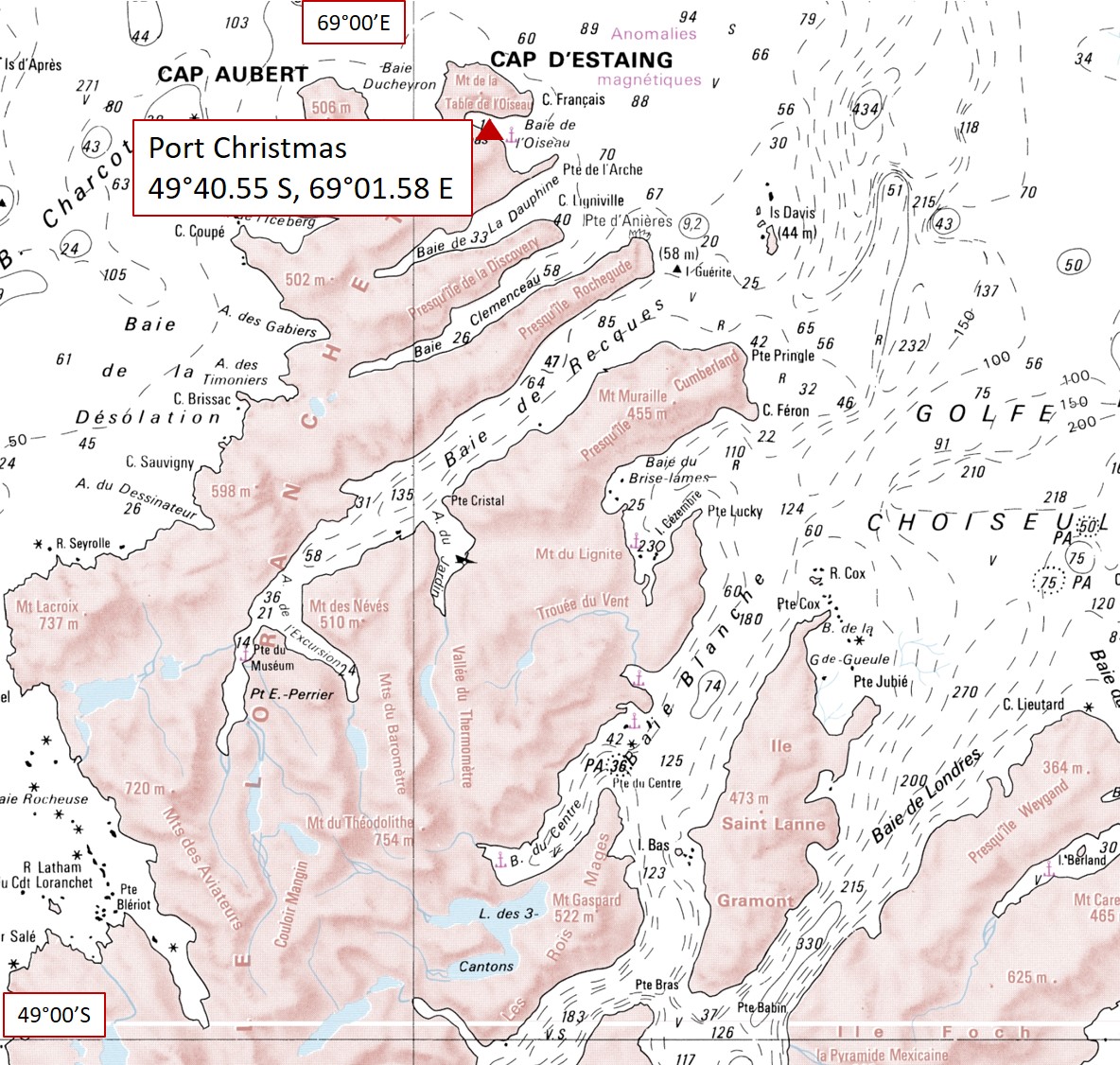
One site in the Baie de l’Oiseau (Golfe Choiseul): Port Christmas [48°40.55′ S; 69°01.58 E / -48.68194; 69.03277]
and one site in the Baie du Hillsborough (Golfe des Baleiniers): Ilôt des Trois Bergers [49°17.24 S; 69°42.41 E / -49.29000; 69.71138]
Ilôt des Trois Bergers (Golfe des Baleiniers) 49°17.24 S | 69°42.41 E / -49.29000 | 69.7113869.71138
Ilôt des Trois Bergers (Golfe des Baleiniers) 49°17.24 S | 69°42.41 E / -49.29000 | 69.7113869.71138
Two sites in the Baie d’Audierne,
in the Fjord des Portes Noires [49°29.39 S; 69°08.58 E; -49.49416 | 69.14944]
and at the Iles du Prince de Monaco (open sea) [49°36.00 S; 69°14.23 E / -49.60000; 69.23972]
Fjord des Portes Noires (Baie d’Audierne) 49°29.39 S | 69°08.58 E / -49.49416 | 69.14944
Iles du Prince de Monaco (Baie d’Audierne) 49°36.00 S | 69°14.23 E / -49.60000 | 69.23972
Two sites were chosen at the bottom of the Baie du Morbihan:
Ile Haute [49°23’15″S; 69°56’29″E / -49.38750; 69.94138]
and Ile Longue (Baie du Morbihan) 49°32’19″S | 69°53’03″E / 49.53861 | 69.88416
Ile Haute (Baie du Morbihan) 49°23’15″S | 69°56’29″E / -49.38750 | 69.94138
Ile Longue (Baie du Morbihan) 49°32’19″S | 69°53’03″E / 49.53861 | 69.88416
Two sites were chosen at the entrance of the Baie du Morbihan, in the Passe Royale:
Ile Suhm [49°29’36″S; 70°09’41″E / -49.49333; 70.16138]
and Ilot Channer [49°22’59″S; 70°11’08″E / -49.38310; 70.18580]

 49°17.24 S | 69°42.41 E / -49.29000 | 69.7113869.71138")
 49°29.39 S | 69°08.58 E / -49.49416 | 69.14944")
 49°36.00 S | 69°14.23 E / -49.60000 | 69.23972")
 49°23’15″S | 69°56’29″E / -49.38750 | 69.94138")
 49°32’19″S | 69°53’03″E / 49.53861 | 69.88416")
 49°29’36″S | 70°09’41″E / -49.49333 | 70.16138")
 49°22’59″S | 70°11’08″E / -49.38310 | 70.18580")